55. The Wading Place

Muddy Creek now empties into Pleasant Bay at Jackknife Cove through a culvert under Route 28. Imagine the road and all the earth above near the culvert gone, so that the mouth of the stream simply extended back into the woods as it gradually narrowed into the flow of a typical creek. This was the terrain when it first became known as The Wading Place. It was the place where the Monomoyick people forded the creek on the coastal path between today’s Chatham and the northern region of their land, and on to the territory occupied by the Nausets, in today’s Orleans and beyond. The spot gave its name to the entire path, which was called the Wading Place Path.
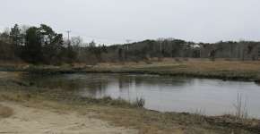
Muddy Creek, upstream from this Wading Place, was the heartland of Monomoyick settlement. Isabel Bell Smith Monomoy River Conservation Lands off Bay Road on the Harwich side includes a 1.25- mile trail that offers a good overview of the creek.
The first bridge over the creek may have been built privately around 1825. The town did not build a bridge until 1875, and this was improved in 1895, which included the first installation of a culvert. An 1890 painting by Elmer Crowell entitled The Wading Place shows a much more expansive bridge than might be imagined today looking at the creek.
Muddy Creek is currently the subject of a study on improving the water quality in Muddy Creek by widening the culvert. It has also been suggested that going back to a bridge would be the best solution for water quality.